
Memorandum
- From
- Derek Weston
- Date
- Filed
- News·3 min to read
- Re
Karina becomes a Pacific hurricane well away from land and is forecast to become a major storm
ReKarina becomes a Pacific hurricane well away from land and is forecast to become a major storm
Hurricane Karina strengthened in the Pacific Ocean far from land and is expected to become a major storm, while dangerous swells and rip currents are likely along parts of Mexico's coast.
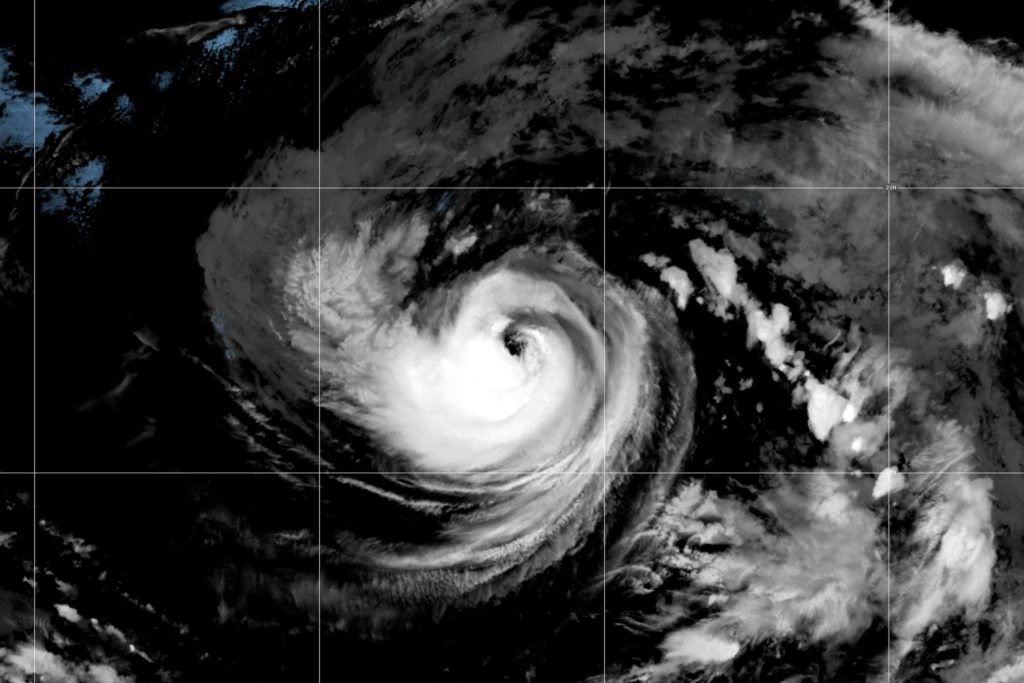
Hurricane Karina has strengthened into a major storm in the eastern Pacific Ocean, far from land, according to forecasters. The storm, which formed from a tropical depression earlier this week, is expected to continue intensifying over the coming days, though it poses no direct threat to coastal communities.
The U.S. National Hurricane Center said Karina reached hurricane status on Saturday and was forecast to become a major hurricane, defined as a Category 3 or higher on the Saffir-Simpson scale. The storm was located hundreds of miles off the coast of Mexico, moving in a generally westward direction over open water.
While Karina was expected to remain well away from land, the hurricane center warned that swells generated by the storm were likely to cause dangerous surf and rip current conditions along parts of southwest Mexico and the Baja California Peninsula. Beachgoers and boaters in those areas were advised to remain alert for hazardous marine conditions over the next several days.
The storm has drawn attention in part because of its position in the Pacific, a region where hurricanes are less common than in the Atlantic but still capable of producing significant impacts. Forecasters noted that Karina's path keeps it far from the U.S. West Coast, including Southern California, where residents have been monitoring the storm's development with interest.
Karina is the latest named storm of the eastern Pacific hurricane season, which typically runs from mid-May through November. The season has been active, with several storms forming in recent weeks, though most have remained over open water.
Meteorologists said the storm's rapid intensification was driven by warm ocean waters and favorable atmospheric conditions, including low wind shear. Such conditions are common in the eastern Pacific during late summer, when sea surface temperatures reach their annual peak.
The hurricane center said Karina was expected to maintain hurricane strength for several days before gradually weakening as it moves into cooler waters and encounters less favorable conditions. No coastal watches or warnings were in effect, and the storm was not expected to make landfall.
Authorities in Mexico, however, urged residents along the Pacific coast to monitor local weather reports and heed any guidance from civil protection officials. Rip currents, which are powerful channels of water flowing away from shore, can be deadly even when a storm is far offshore.
The National Hurricane Center continues to track Karina and will issue updates as the storm evolves. Forecasters emphasized that while the storm's distance from land limits its immediate threat, the ocean conditions it generates can still pose risks to those in coastal areas.
57